Making decisions about how to prepare for the impacts of climate change can be complex, expensive, and have long-term implications. Therefore, it is important that these decisions are based on the best available evidence. Below you will find different sources of climate data to help with your decision-making.
Climate Data
Climate Atlas
The Climate Atlas of Canada combines climate science, mapping and storytelling to bring the global issue of climate change closer to home for Canadians. It is designed to inspire local, regional, and national action that will let us move from risk to resilience. The Climate Atlas of Canada is an interactive tool for citizens, researchers, businesses, and community and political leaders to learn about climate change in Canada. It combines climate science, mapping and storytelling to bring the global issue of climate change closer to home, and is designed to inspire local, regional, and national action and solutions. The Atlas…
Climate Change Hazards Information Portal (CCHIP)
CCHIP is a web-based tool that uses data from 40 of the most recent Global Climate Models and many other sources to provide defensible, actionable conclusions about changes across a whole array of climate and severe weather-related conditions. By tailoring this information for specific locations and sectors, CCHIP helps planners, engineers, and decision-makers account for future climate change impacts. CCHIP is designed to provide information for agricultural and other natural resource management uses, as well as emergency management and public health applications. CCHIP allows users to access a wide variety of climate data, while contextualizing it at the same time.…
CCCS: Canadian Centre for Climate Services
The CCCS is an initiative of the Government of Canada and provides access to all things climate, from climate basics through to data and resources that support adaptation decision-making. The new CCCS website is designed to facilitate access to climate data and tools through features such as the Library of Climate Resources, interactive climate data viewer, and extraction tool. For the first time, Canadians can access Environment and Climate Change Canada’s climate data through an interactive map, download climate data subsets relevant for their purpose, and use our the library of resources to access climate datasets and resources consolidated across…
OCDP: Ontario Climate Data Portal
The Ontario Climate Data Portal (OCDP) was recently launched to ensure technical or non-technical end-users (e.g. municipalities, private sector) have easy and intuitive access to the latest robust climate data over the Province of Ontario, Canada. The OCDP incorporates the high-resolution (10 km x 10 km) climate projections developed by the LAMPS at the York University using state-of-the-science combined downscaling technique based on a large ensemble of global and regional climate model results released under the latest IPCC AR5. The 209-member ensemble accounted for projections developed by other jurisdictions such as members of NA-CORDEX, PCIC, OURANOS, University of Toronto, York…
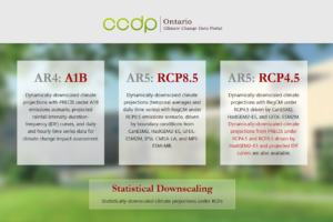
CCDP: Ontario Climate Change Data Portal
While the OCDP hosts the higher resolution projections based on a huge ensemble to better address the uncertainties, the Ontario Climate Change Data Portal (Ontario CCDP) is still in commission to distribute its unique dynamically downscaled projections over Ontario. Ontario CCDP incorporates the high-resolution (25 km x 25 km) climate projections developed by the IEESC at the University of Regina using the PRECIS modeling system. This user-friendly data portal provides both visual representations and data downloading functions of climate scenarios across Ontario using geospatial maps, including typical climate change indicators (e.g. temperature, precipitation) at temporal scales from annual, seasonal, monthly…
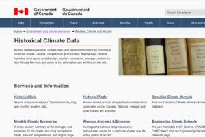
National Climate Data and Information Archive
The National Climate Data and Information Archive, hosted by Environment Canada, provides practitioners with historical climate data that can be used to determine a baseline and be used in planning, design and implementation activities. The services provided include historical climate data (hourly, daily or monthly for stations across Canada), historical radar images from 31 stations across Canada, Canadian climate normals (averages and extremes for nearly 1500 locations in Canada), Engineering Climate Datasets (IDF curves, CWEEDS -Weather Energy and Engineering Datasets, CWEC- Canadian Weather year for Energy Calculation), and monthly climate summaries of averages and extremes across the country. The site…
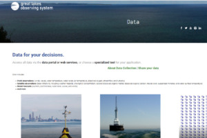
Great Lakes Observing System
Data includes point observations (winds, waves, water temperature, water levels, air temperature, dissolved oxygen, streamflow, and turbidity), satellite observations (base reflectivity including weather hazards, chlorophyll concentration, colored dissolved organic matter, dissolved organic carbon, natural color, suspended minerals, and water surface temperature), model forecasts (currents, ice thickness, water level, waves, and winds) and more. visit this site
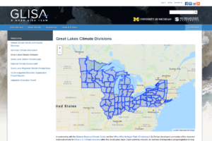
Great Lakes Integrated Sciences & Assessments (GLISA)
The Great Lakes Integrated Science and Assessments (GLISA) website hosts a collection of climate data resources from different institutions that provide international, federal, regional and local climate data on a variety of spatial and temporal resolutions. The data is derived from several GCM and RCM models, downscaled projections and gridded observations. Practitioners are able to access a variety of datasets and portals from across Canada and the US, as well as the accompanying documentation. The resources are indexed so that users can easily locate climate data by specifying parameters, indices, downscaling method and scale of interest. visit this site
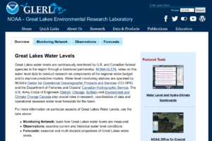
Great Lakes Water Level Dashboard
The National Oceanic and Atmospheric Administration (NOAA) has developed the Great Lakes Water Level Dashboard and the Great Lakes Hydro-Climate Dashboard for use by practitioners in monitoring lake levels and forecasts for the Great Lakes. The Water Level Dashboard provides users with the ability to view lake levels and forecasts in a variety of timescales. The Hydro-Climate Dashboard adds hydro-climate data sets to water level information, allowing users to directly compare the Great Lakes water levels with the primary drivers of their fluctuation. The Hydro-Climate tool includes data sets for Monthly precipitation, runoff, over-lake evaporation, net basin supply and ice…
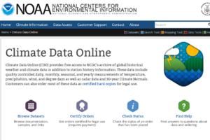
NOAA National Climatic Data Centre
Climate Data Online (CDO) provides free access to the National Climatic Data Centre’s archive of historical weather and climate data in addition to station history information. The dataset and mapping tools provide practitioners with documentation and information, as well as options for viewing data by regions. Developed by the National Oceanic and Atmospheric Administration (NOAA), the CDO also provides links to additional data resources for practitioners that have other data needs. visit this site
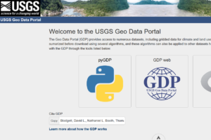
USGS Geo Data Portal
Many natural resource management questions involve a variety of data that are challenging to work with using typical computer resources. The USGS Geo Data Portal (GDP) removes the barrier to these large or complex data by moving processing to the web. This gives researchers and managers access to powerful computers and software tools with minimal effort, enabling them to produce important results with less investment. The Geo Data Portal (GDP) provides access to numerous datasets, including gridded data for climate and land use. Datasets can be subsetted or sumarized before download using several algorithms, and these algorithms can also be…
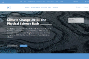
IPCC – Global and Regional Climate Change Projections
The Working Group I contribution to the IPCC’s Fifth Assessment Report (AR5) considers new evidence of climate change based on many independent scientific analyses from observations of the climate system, paleoclimate archives, theoretical studies of climate processes and simulations using climate models. It provides a comprehensive assessment of the physical science basis of climate change in 14 chapters, supported by a number of annexes and supplementary material. It includes global and regional climate change projections. visit this site